Power Company Services
Contego-ENV & Woolpert Capabilities Overview
Joint Services and Solutions for Integrated Environmental, Geospatial, Utility Asset, and Grid Resilience Programs
Executive Summary
Contego-ENV and Woolpert offer utility owners and operators an integrated delivery team purpose-built to support environmental compliance, utility corridor management, asset intelligence, vegetation and wildfire risk reduction, geohazard assessment, field mobility, and enterprise GIS modernization. Together, the team combines environmental program expertise with large-scale geospatial data acquisition, AI/ML analytics, engineering-grade mapping, systems integration, and utility-focused application development to help organizations transform complex field conditions into trusted, actionable, and auditable decisions.
The joint value proposition is straightforward: collect defensible environmental and infrastructure data once, validate it against field and system-of-record realities, convert it into prioritized work, and integrate the results into the enterprise platforms utilities already rely on for planning, operations, compliance, and capital investment decisions.
Partnership Positioning
Contego-ENV brings environmental, natural resource, and regulatory implementation experience that helps utilities define requirements, assess field and ecological risk, document compliance, and translate regulatory obligations into executable programs. Woolpert complements that foundation with enterprise geospatial strategy, survey-grade reality capture, utility asset mapping, remote sensing, GIS integration, field applications, and operational analytics at scale.
As a combined team, Contego-ENV and Woolpert can serve utility clients as both a strategic advisor and an execution partner—supporting program design, field deployment, data production, analytics, system integration, and long-term operationalization across electric transmission, distribution, generation, renewables, environmental assets, rights-of-way, substations, underground infrastructure, and high-risk corridors.
Integrated Services and Solutions
1. Environmental Compliance, Permitting, and Field Program Support
The Contego-ENV and Woolpert team supports environmental compliance programs that require defensible field documentation, geospatial traceability, and repeatable workflows. Services may include environmental screening, permit support, habitat and resource documentation, wetlands and waterbody mapping, right-of-way environmental constraints analysis, construction monitoring support, restoration tracking, and compliance reporting. By integrating environmental field observations into GIS-enabled systems of record, the team helps utilities move from static documentation to living, map-based compliance intelligence.
2. Survey-Grade Asset Awareness and Utility Corridor Intelligence
Woolpert’s corridor management approach establishes a survey-grade geospatial foundation using land survey, ground control, aerial LiDAR, mobile LiDAR, drone data, high-resolution imagery, satellite data, and ground penetrating radar where applicable. These datasets are processed into asset locations, features, conditions, and derivative work products that improve utility asset inventory, GIS data quality, engineering analysis, vegetation management, storm response, route optimization, and capital planning.
This foundation helps utilities reconcile the physical grid with enterprise systems of record by tightening asset locations, verifying attributes, closing data gaps, and creating a defensible baseline for grid modernization. The result is trusted data that can be used across departments rather than isolated point solutions.
3. Asset Inventory, GIS Corrections, and System-of-Record Reconciliation
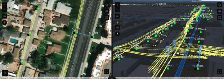
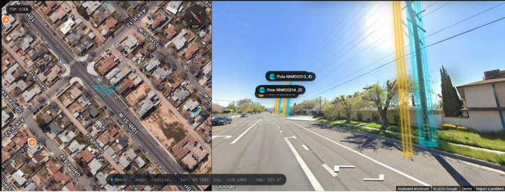
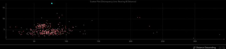
The joint solution fuses land survey, imagery, LiDAR, mobile mapping, Street View, and field verification to extract sub-meter asset coordinates, identify asset attributes, and compare those observations against existing GIS and enterprise asset management records. Discrepancies can be flagged, reviewed, corrected, and routed for field validation where required.
This capability supports mass reconciliation between Esri GIS, enterprise asset management platforms, work management tools, engineering records, field applications, and operational dashboards. The approach improves asset data integrity, reduces orphaned or stale records, supports topology correction, strengthens outage response, and provides a traceable basis for regulatory and operational decision-making.
4. Vegetation, Wildfire, and Grid Resilience Management
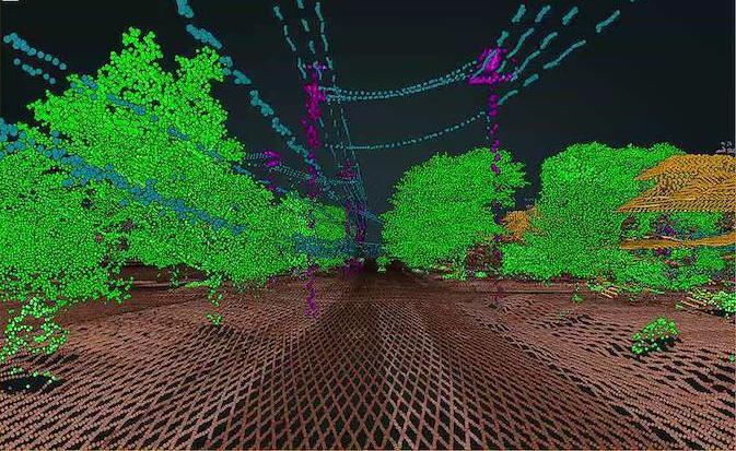
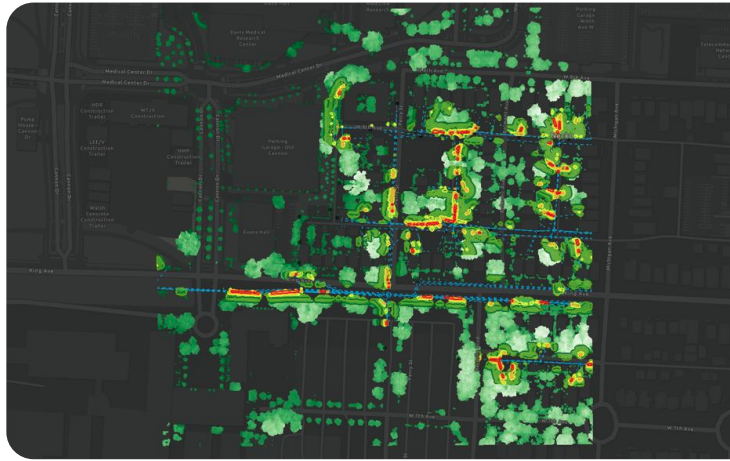
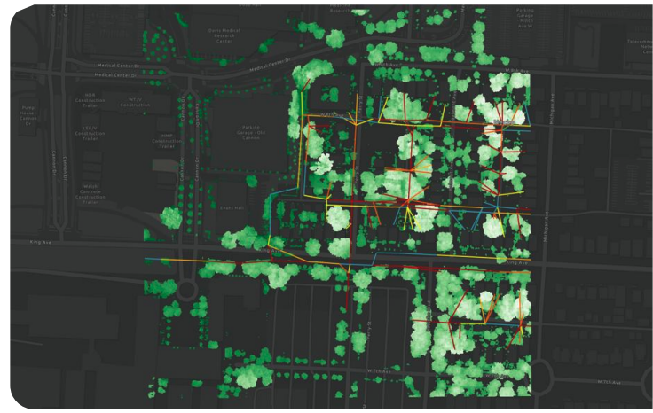
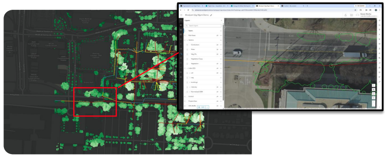
Contego-ENV and Woolpert support vegetation and wildfire risk programs through LiDAR- and imagery-based vegetation identification, conductor and structure vectorization, clearance modeling, vegetation condition assessment, risk scoring, and work order generation. Vegetation risk can be evaluated by span, circuit, asset, or canopy polygon, enabling utilities to move from broad-cycle maintenance toward risk-prioritized vegetation management.
When combined with environmental constraints, field access considerations, contractor performance data, and historical outage patterns, this solution helps prioritize the right work in the right locations. It supports reduced truck rolls, improved contractor productivity, traceable compliance, improved storm readiness, wildfire mitigation planning, and better alignment between vegetation work, reliability objectives, and regulatory expectations.
5. Geohazard, Landslide, Water Crossing, and Corridor Risk Management
The team helps utilities identify, monitor, and prioritize geohazards that threaten utility corridors, access routes, substations, pipelines, transmission structures, water crossings, and critical infrastructure. Bare-earth LiDAR, imagery, terrain modeling, hydrologic indicators, field observations, and change detection can be used to create a living geohazard inventory and assess risk based on proximity, movement potential, severity, and consequence.
This framework supports an observe-relate-assess-act-defend model: observe corridor conditions, relate hazards to assets, assess risk through defensible scoring, act through field inspection or engineered mitigation, and defend decisions through versioned and auditable documentation. The result is a practical path to risk-informed corridor integrity management.
6. Field Mobility, Work Optimization, and Closed-Loop Execution
The joint team converts prioritized risks, inspections, anomalies, and maintenance needs into executable digital work packages. Field workflows can support disconnected data collection, GPS-enabled inspection, safety checklists, photo documentation, contractor progress tracking, and synchronization with enterprise systems.
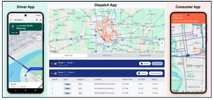
Woolpert’s mobility and routing capabilities integrate optimization engines, fleet routing, work dispatch, and mobile field applications to reduce windshield time, improve crew utilization, sequence work geographically, and provide shared visibility between operations, field crews, contractors, and stakeholders. This closed-loop model ensures work is not only identified and prioritized, but also assigned, completed, verified, and fed back into the utility’s systems of record.
7. Enterprise GIS, Data Governance, and Decision Support
Woolpert’s enterprise GIS experience includes designing centralized geospatial repositories, integrating business systems, deploying Esri Enterprise and ArcGIS Online environments, building custom web applications, supporting field mobility, and connecting GIS to engineering, maintenance, outage, work management, real estate, document management, and executive reporting platforms.
For utility clients, this means environmental, asset, vegetation, geohazard, inspection, outage, and work management data can be accessed through a common geospatial interface. The combined team helps establish data standards, QA/QC workflows, authoritative asset layers, dashboard reporting, role-based access, audit trails, and scalable governance practices that support enterprise adoption.
Representative Use Cases
| Use Case | Joint Team Capability | Operational Value |
|---|---|---|
|
Use Case
Environmental compliance and permitting
|
Joint Team Capability
Environmental field documentation, GIS-enabled constraints mapping, permit tracking, and auditable reporting
|
Operational Value
Improved regulatory defensibility, better project readiness, and clearer compliance documentation
|
|
Use Case
Asset inventory and GIS correction
|
Joint Team Capability
Survey-grade LiDAR, imagery, feature extraction, GIS delta detection, and system-of-record reconciliation
|
Operational Value
Improved asset confidence, reduced data gaps, and stronger foundation for planning and operations
|
|
Use Case
Vegetation and wildfire risk
|
Joint Team Capability
Clearance modeling, vegetation condition assessment, AI/ML risk analytics, and prioritized work generation
|
Operational Value
Risk-based vegetation investment, improved reliability, and traceable mitigation decisions
|
|
Use Case
Storm and outage response
|
Joint Team Capability
Change detection, field routing, mobile inspection, operational dashboards, and crew visibility
|
Operational Value
Faster situational awareness, more efficient response, and improved restoration coordination
|
|
Use Case
Geohazard and corridor integrity
|
Joint Team Capability
Bare-earth LiDAR, hazard inventory, risk scoring, field validation, and monitoring workflows
|
Operational Value
Earlier identification of slope, water crossing, and terrain threats to critical infrastructure
|
|
Use Case
Field work optimization
|
Joint Team Capability
Optimized routing, dispatch support, field data capture, contractor tracking, and closed-loop updates
|
Operational Value
Reduced truck rolls, improved productivity, and stronger feedback into enterprise systems
|
|
Use Case
Site Selection & Civil Engineering
|
Joint Team Capability
Identify ideal sites for construction: generation, data centers, transmission & distribution circuits, substations, and EV charging
|
Operational Value
Compiled geospatial and other relevant datasets for reduced planning-to-shovel timelines for construction
|
Differentiators
- Environmental + geospatial integration: The partnership connects environmental program execution with survey-grade geospatial data, analytics, and enterprise
systems. - Collect once, use many times: Foundational datasets can support asset
management, vegetation, environmental compliance, geohazards, storm response, engineering, and planning. - Trusted system-of-record alignment: Physical-world observations are reconciled with GIS, EAM, work management, and operational systems to improve confidence and usability.
- Risk-prioritized work: Analytics convert field conditions into prioritized actions by span, asset, corridor, canopy, site, or geography.
- Closed-loop field execution: Work is identified, optimized, dispatched, completed, verified, and synchronized back to enterprise systems.
- Defensible decision-making: Versioned data, repeatable workflows, and auditable outputs support regulatory, safety, reliability, and capital planning decisions.
Proposed Joint Value Statement
Contego-ENV and Woolpert are positioned to help utilities modernize how environmental, asset, vegetation, geohazard, and field operations data are collected, governed, analyzed, and operationalized. By combining environmental field expertise with enterprise geospatial intelligence, the team delivers defensible data, actionable risk insights, optimized work execution, and scalable system integration across any service territory.
This partnership gives utility owners and operators a practical path to improve safety, reliability, compliance, field efficiency, and grid resilience through a unified data foundation and repeatable delivery model.
Appendix
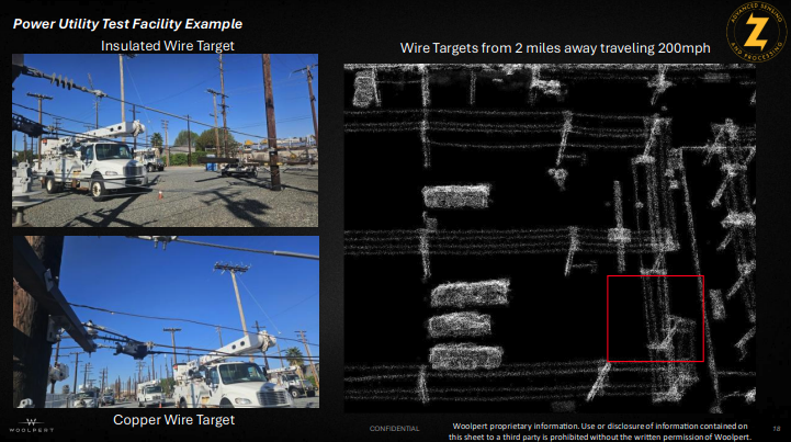
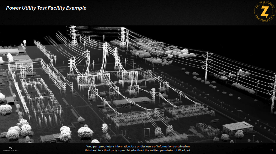
Woolpert HD Aerial LiDAR – Zeus
Utility Asset Identification, GIS & Reconciliation from LiDAR & Imagery
LiDAR & Imagery Enabled Vegetation Management
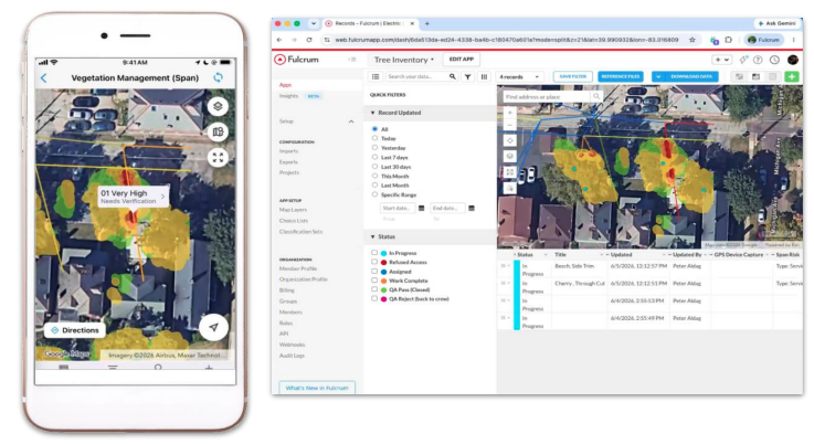
Google Maps Enabled Field Work Fleet Dispatching, Optimized Field Service Routing and Customer Notifications